


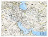
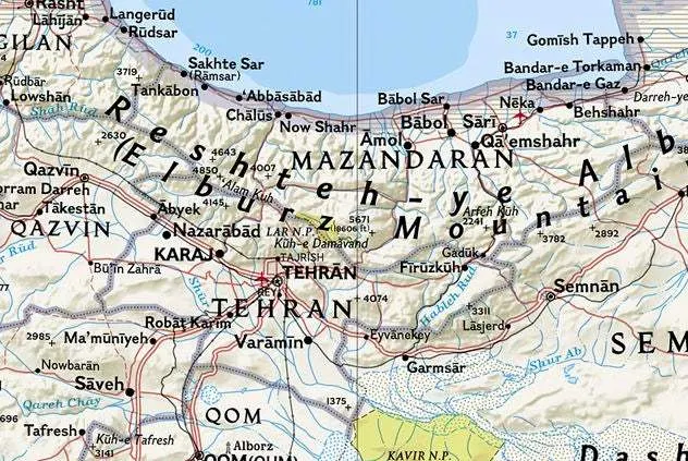
This new map of Iran is made with the classic National Geographic reference styling. It features thousands of place names, accurate political boundaries, archeological sites, and major infrastructure networks such as roads, canals, ferry routes, and railroads.
Iran's diverse terrain is detailed through accurate shaded relief, coastal bathymetry, and symbolism for water features and other landforms. Elevations of major peaks are expressed in both feet and meters; depth soundings are expressed in fathoms.
National Geographic is a renowned authority in cartography. For 120 years the Society's maps have helped spread geographic knowledge around the globe. A vast database allows National Geographic to combine the latest data gained by space-age technology with innovative digital mapping techniques to create state-of-the-art political, physical, and thematic maps. The Society's meticulous research and attention to detail have established a standard of achievement that is unparalleled.

")


